Looming Sask. heatwave set to send temperatures soaring
REGINA -
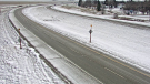
Temperatures will top out at just below seasonal with unsettled and rainy conditions through southern Saskatchewan on Thursday. However when you look past today, you see we’re in for an impending heatwave.
That’s right! It is getting hot, hot, hot!
Starting Friday, conditions start to clear up a little as a ridge of high pressure, or what’s better described as a “heat dome,” makes its way into western Canada. This looks to bring the highest temperatures to British Columbia and southern Alberta for the weekend and week ahead, but it also going to push temperatures into the low and mid 30s for southern Saskatchewan for the better part of next week.
Environment and Climate Change Canada are calling this a “dangerous and historic” heatwave.
Basically, this type of upper atmosphere pattern brings hot air that gets trapped under a “dome,” meaning that even the overnight temperatures won’t offer much relief, dropping only back down to around 16-18 degrees Celsius for most communities including Swift Current, Saskatoon and Regina.
The hottest daytime highs look to be in the province Monday to Thursday of next week, which means we expect a prolonged period of extreme heat.
This heatwave is likely to trigger a period of extreme heat warnings for Saskatchewan as these warnings are already in effect for other areas of western Canada including most of British Columbia.
The threshold for these warnings in the province is two days of temperatures over 29 degrees Celsius for northern communities with lows over 14 degrees, or two days over 32 degrees Celsius for southern Saskatchewan with lows over 16 degrees.
Now, it’s not all sunshine on the way either. A few showers and storms look to stretch through southern and eastern communities on Saturday, bringing the risk of isolated thunderstorms to Regina, Prince Albert and Saskatoon. The same thing is true on Tuesday. So, expect a few bursts of unsettled conditions mixed in with all the heat.
But, the heat is the thing we are worried about since it requires people to be cautious and monitor for signs of heat related illness.Temperatures above 30 degrees require increased hydration, as well as shelter.
So that means always monitor how you are feeling when you are outside, avoid strenuous activities in the heat, seek air conditioning when possible and drink all the water!
Also, we are likely to see an increase in fire risk, so as we head towards the start of July, just make sure you are being fire safe out there when it comes to campfires, fireworks and ATVs especially.
As I said before, it is being called a historic heatwave and that means it is also likely that many daily temperature records will fall next week in southern and western Saskatchewan. As for all-time records, the highest temperatures ever recorded in Canada were on July 5, 1937, according to Environment and Climate Change Canada when both Midale and Yellowgrass, Saskatchewan soared above 45 degrees Celsius.
These records may be in jeopardy as the mercury rises in British Columbia over the next week – meaning we might lose that title – even though it is getting hot, hot, hot here too, but right now it doesn’t look like we will get as hot as the provinces to our west.


CTVNews.ca Top Stories

They were from different countries and barely spoke each other's languages. More than 20 years later, they're still happily in love
He decided to spend Christmas somewhere that wouldn't involve snowstorm disasters. She was spending the holidays with family, travelling for the first time outside of her native country of Venezuela. 23 years later, they're still in love.
Man who set himself on fire outside Trump trial dies of injuries, police say
A man who doused himself in an accelerant and set himself on fire outside the courthouse where former U.S. President Donald Trump is on trial has died, police said.
Verdun Airbnb listing taken down amid complaints, fines and frustration from neighbours
An Airbnb in Montreal's Verdun borough was the source of much frustration from neighbours who say there were constant parties at the location. It has been taken down from the app, but housing advocates remain upset about short-term rentals.
Young people 'tortured' if stolen vehicle operations fail, Montreal police tell MPs
One day after a Montreal police officer fired gunshots at a suspect in a stolen vehicle, senior officers were telling parliamentarians that organized crime groups are recruiting people as young as 15 in the city to steal cars so that they can be shipped overseas.
Fire in Labrador town under control, officials tells residents to stay away
RCMP say the fire that prompted a state of emergency in a Labrador town is now under control.
12 students and teacher killed in Columbine school shooting remembered at 25th anniversary vigil
Thirteen victims of the Columbine High School shooting were remembered during a vigil Friday on the eve of the 25th anniversary of the shooting that was the worst the nation had seen at the time.
Israeli airstrike in southern Gaza city of Rafah kills at least 9 Palestinians, including 6 children
An Israeli airstrike on a house in Gaza's southernmost city killed at least nine people, six of them children, hospital authorities said Saturday, as Israel pursued its nearly seven-month offensive in the besieged Palestinian territory.
Mandisa, Grammy award-winning 'American Idol' alum, dead at 47
Soulful gospel artist Mandisa, a Grammy-winning singer who got her start as a contestant on 'American Idol' in 2006, has died, according to a statement on her verified social media. She was 47.
Iraq investigates a blast at a base of Iran-allied militias that killed 1. U.S. denies involvement
Iraqi authorities said Saturday that they were investigating an explosion that struck a base belonging to the Popular Mobilization Forces, a coalition of Iran-allied militias, killing one person and injuring eight.
Shopping Trends
The Shopping Trends team is independent of the journalists at CTV News. We may earn a commission when you use our links to shop. Read about us.


Saskatoon
-

‘My family are all broken-hearted’: Grandfather of homicide victim speaks out
Saskatoon is grappling with the tragic death of 24-year-old Melissa Duquette, whose body was discovered on April 15. A day later, authorities confirmed her death as a homicide, sparking deep sorrow and calls for action within the community.
-
Saskatoon judge to make ruling on evidence in fatal THC-impaired driving case
A Saskatoon Provincial Court judge will determine whether testimony from a woman, charged with impaired driving causing the death of a child, will be used as evidence in her trial.
-
Sask. Teachers' Federation sending offer to a vote 'tactical move': labour scholar
Teachers have three weeks to consider how they’ll vote on an offer from the provincial bargaining committee. But where does the dispute go next?
Winnipeg
-

'Like part of the family': St. Boniface burger staple back after closing down last year
Mrs. Mikes shut down last year after a half-century of serving the community. Now its doors have reopened and Winnipeggers were lined up to get their fill, even as snow fell on them.
-
Winnipeg airport's longest runway is getting a facelift
The Winnipeg Airports Authority is doing an extensive repaving project to its largest runway.
-
Manitoba mom praises quick-thinking fire department for freeing daughter stuck in playground equipment
A Manitoba mother is praising firefighters for their quick work in helping her daughter who got stuck at a playground in Lorette, Man.
Edmonton
-

Spit, punches and bites: School support staff detail rising violence from students
A former educational assistant is calling attention to the rising violence in Alberta's classrooms.
-
New report suggests Alberta's emissions reduction plan made little progress in first year
Alberta has done little to advance its plan to reduce greenhouse gas emissions a year after introducing it, an analysis suggests.
-
The House is on the brink of approving aid for Ukraine and Israel after months of struggle
The House is preparing in a rare Saturday session to approve US$95 billion in foreign aid for Ukraine, Israel and other U.S. allies.
Calgary
-
Voluntary water limits put in place in face of possible Alberta drought
More than three dozen of Alberta's largest water users have agreed with a provincial plan to cut back on water usage this year ahead of a severe drought expected this summer.
-
From 'barely surviving, to living': Calgary family champions local mental health supports
It seemed like their world was crashing in when free mental health services changed the lives of a Calgary family and now they are trying to help others get the same support.
-
Abbotsford scores late in overtime to topple Wranglers 4-3
The Calgary Wranglers picked up a single point Friday night, dropping a 4-3 decision to the Canucks in an American Hockey League (AHL) game played in Abbotsford.
Lethbridge
-
Lethbridge cutting back on water use as part of provincial water sharing agreement
The province has announced the largest water sharing agreement in Alberta’s history, which will see Lethbridge and Medicine Hat, among other municipalities, cut water use.
-
Medicine Hat woman charged after $60K stolen from Redcliff Legion
Mounties say a 32-year-old Medicine Hat woman has been charged in connection with the theft of $60,000 from the Redcliff Legion.
-
Deterrent sentence possible, expert says, after trio convicted in connection to Coutts border blockade
Three men who helped lead and co-ordinate the 2022 border blockade at Coutts, Alta., have been found guilty of public mischief.
Toronto
-

What to expect for Toronto Maple Leafs playoffs against Boston Bruins
The next chapter of the Toronto Maple Leafs rivalry with the Boston Bruins is set to unfold on Saturday night.
-
How to revive your lawn after winter and avoid long-lasting damage: experts
Winter weather can cause long-lasting damage to your front lawn, according to experts – the key to a healthy revival lies in a few simple maintenance practices.
-
U.S. FAA launches investigation into unauthorized personnel in cockpit of Colorado Rockies flight to Toronto
The U.S.’s Federal Aviation Administration is investigating a video that appears to show unauthorized personnel in the cockpit of a charted Colorado Rockies flight to Toronto.
Ottawa
-

Manor Park shooting leaves man dead, Ottawa police investigating
The Ottawa Police Service Homicide Unit is investigating a shooting that happened Friday evening on Birch Avenue.
-
Child not secured, mother holding baby on Highway 401 in eastern Ontario, driver facing charges
The Ontario Provincial Police (OPP) says a car that was initially stopped for stunt driving on Highway 401 in eastern Ontario had a child and a baby not safely seated Friday evening.
-
Ottawa is for the birds: Tips for birdwatching in the nation's capital
As springtime gets into bloom, birds that call Ottawa home are either migrating back to the area or becoming more active.
Montreal
-

Verdun Airbnb listing taken down amid complaints, fines and frustration from neighbours
An Airbnb in Montreal's Verdun borough was the source of much frustration from neighbours who say there were constant parties at the location. It has been taken down from the app, but housing advocates remain upset about short-term rentals.
-
Iconic ninth floor Eaton Centre restaurant set to reopen in May
There was once a beautiful restaurant on the ninth floor of the former Eaton's department store. It closed 25 years ago, but many in Montreal still talk about it. Soon, Le 9ieme will open to diners once again.
-
Young people 'tortured' if stolen vehicle operations fail, Montreal police tell MPs
One day after a Montreal police officer fired gunshots at a suspect in a stolen vehicle, senior officers were telling parliamentarians that organized crime groups are recruiting people as young as 15 in the city to steal cars so that they can be shipped overseas.
Vancouver
-

First Nation solar farm in B.C. expected to save 1.1 million litres of diesel a year
A First Nation in central British Columbia will build what the federal government says will likely be the largest off-grid solar project in Canada.
-
B.C. judge orders shared dog custody for exes who both 'clearly love Stella'
In a first-of-its-kind ruling, a B.C. judge has awarded a former couple joint custody of their dog.
-
Vancouver nurse, union say concerns over drug use in hospitals politicized
A Vancouver nurse is speaking out, saying politicians are using recent accounts of concerns related to the safety of health-care workers for political gain.
Vancouver Island
-
First Nation solar farm in B.C. expected to save 1.1 million litres of diesel a year
A First Nation in central British Columbia will build what the federal government says will likely be the largest off-grid solar project in Canada.
-
'It was joy': Trapped B.C. orca calf eats seal meat, putting rescue on hold
A rescue operation for an orca calf trapped in a remote tidal lagoon off Vancouver Island has been put on hold after it started eating seal meat thrown in the water for what is believed to be the first time.
-
B.C. Humanist Association threatens to sue Vancouver Island city over council prayer
The B.C. Humanist Association has announced plans to sue a Vancouver Island city for breaching religious neutrality by including a Christian prayer in council.
Kelowna
-

Stolen snake named Milkshake returned to Kelowna pet store
A banana ball python that was stolen from a Kelowna pet store on Saturday has been returned unharmed, Mounties said.
-
Nurses rally at B.C. Interior hospital over security, staffing concerns
Nurses held a rally Wednesday at a hospital in the B.C. Interior that closed its emergency department more than a dozen times last year due to insufficient staff.
-
B.C. to add 240 complex-care housing units throughout province
British Columbia is planning to add 240 new units to its complex-care housing program, providing homes for people with mental-health and addictions challenges that overlap with other serious conditions.
London
-

Early morning shooting under investigation by London police
Police say a man was found with a gunshot wound just before 5 a.m. Saturday in a northwest London neighbourhood.
-
ICYMI
ICYMI CTV News London's top stories from this week
In case you missed it, CTV News London has compiled all the top local stories from this week into one video for your convenience.
-
Are London Transit buses already too full to accommodate free passes for high school students?
Leadership at London Transit cautions that the logistics need to be worked out before approving a free bus pass pilot project for high school students by this September.
Kitchener
-

NDP leader likens Wilmot farmland grab to Greenbelt scandal
A controversial land acquisition proposed in Wilmot Township is once again in the spotlight, as Ontario NDP leader Marit Stiles hosts a town hall in the community, calling the deal “eerily similar” to the Greenbelt scandal.
-
'I'm still shaking': Emotional victim impact statements shared after impaired double-fatal crash in Cambridge
It was an emotional day in court as close to a dozen people read victim impact statements to the man charged with impaired driving in a double-fatal Cambridge crash.
-
Kitchener golfer recognized as creator of Masters skip-shot tradition
A Canadian Hall of Fame golfer from Kitchener is finally getting recognition for starting the skip-shot tradition at The Masters.
Northern Ontario
-

Vicious attack on a dog ends with charges for northern Ont. suspect
Police in Sault Ste. Marie charged a 22-year-old man with animal cruelty following an attack on a dog Thursday morning.
-
They were from different countries and barely spoke each other's languages. More than 20 years later, they're still happily in love
He decided to spend Christmas somewhere that wouldn't involve snowstorm disasters. She was spending the holidays with family, travelling for the first time outside of her native country of Venezuela. 23 years later, they're still in love.
-
Flood warning issued for Lake Nipissing shoreline in North Bay
A flood warning was issued Friday for the Lake Nipissing shoreline in North Bay, Callander and the Parks Creek watershed.
Atlantic
-

Nova Scotia justice minister resigns following domestic violence comments
Nova Scotia Justice Minister Brad Johns has resigned, according to a short statement from Premier Tim Houston on Friday evening.
-
Lyrid meteor shower nears peak; viewing opportunities in the Maritimes
CTV Atlantic meteorologist Kalin Mitchell says a large part of the Maritimes should have ideal viewing conditions for the Lyrid meteor shower Sunday overnight into Monday morning.
-
RCMP seek help identifying person of interest after arson in Back Bay, N.B.
The St. George RCMP is asking for help from the public in identifying a person of interest after an alleged arson at a wharf in Back Bay, N.B., on Thursday.
N.L.
-

N.L. gardening store revives 19th century seed-packing machine
Technology from the 19th century has been brought out of retirement at a Newfoundland gardening store, as staff look for all the help they can get to fill orders during a busy season.
-
500 Newfoundlanders wound up on the same cruise and it turned into a rocking kitchen party
A Celebrity Apex cruise to the Caribbean this month turned into a rocking Newfoundland kitchen party when hundreds of people from Canada's easternmost province happened to be booked on the same ship.
-
Protest averted as Newfoundland and Labrador premier helps reach pricing deal on crab
A pricing agreement has been reached between crab fishers and seafood processors that will allow for Newfoundland and Labrador's annual crab fishery to get started.


