REGINA -- What’s that age-old saying? “In like a lion, out like a lamb?”
Well in this case it looks to be the exact opposite for the end of March 2021. We started the month with fairly calm, warm and dry conditions. But after one round of snow and rain this last week, we are making way for the main act: a potent spring storm heading across the prairies.
This storm looks to turn spring on its head, so much so I hope you didn’t take your winter tires off, though you’ll likely not want to be driving out there anyways.
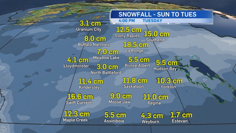
So, what’s happening? An Alberta Clipper looks to develop Saturday, with the warm front sweeping through Saskatchewan overnight into Sunday. This will bring a few centimetres of snow to northern Saskatchewan communities. It looks like Uranium City is likely to see five to 10 centimetres with the warm front, while Stony Rapids, La Ronge, Buffalo Narrows and Southend will see up to five centimetres just on Sunday alone.
Through southern and central Saskatchewan, we expect a well above seasonal Sunday with that warm air. But here’s the catch -- don’t let the sunny, warm day fool you because the low and the cold front are on the way. As they move into the province, they will bring heavy snow and gusting winds.
The low will enter the province through the early hours of Monday and currently, looks to track just north of Saskatoon. But there is still some model variation on exactly where it will move through. Currently the track shows that Saskatoon and Prince Albert will see rain and a messy mixture before it turns to heavy snow later in the day with 10-15 centimetres likely.
After that, the low moves into Manitoba and behind it we are going to see the heaviest snow and gusting winds with this system right across the province mainly through Monday afternoon and evening.
In Regina, that warm air will continue to stick around until Monday morning, though there is a chance of a few showers through the early hours of Monday. You’ll likely start your work week with cloudy conditions and winds gusting to only 30 km/h. But things are set to change as you head towards lunch and the evening.
Snow looks to start around noon and the wind gusts will increase through the early afternoon. The heaviest snow looks to fall Monday afternoon and evening, with a few centimetres continuing through Tuesday morning when the storm moves fully into Manitoba. Total accumulations look to be 6-12 centimetres in Regina. As for winds, which are the bigger concern, we are likely to see gusts to 80 km/h, but they could get higher, even reaching that 100 km/h mark.
Other communities that look to have high snowfall totals are Swift Current, Maple Creek and Kindersley with 10-20 centimetres possible. And most of southern Saskatchewan is likely to see high wind gusts to 100 km/h. With gusts to 70 km/h continuing through Tuesday.
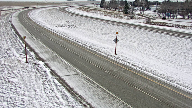
Now, you can see where I’m going with this, can’t you? With heavy snow and gusting winds, we could see blizzard conditions with reduced visibility, so be prepared for possible road closures, as well as reduced visibility and bad travel conditions. We will likely see some hard-hit areas along the Trans-Canada too.
Just be prepared that you’ll start your Monday in different conditions than you’ll end it.
Stay safe, be prepared and expect not to travel on Monday.
