REGINA -- Have you enjoyed the spring weather lately? I definitely have, so I’m a bit sad to say we are getting a break from it starting on Sunday.
Below seasonal temperatures are on the way into the province for the first time this April, and we are likely to see some precipitation that starts with an S. Yep, I’m saying it – snow. I know! It seems taboo to even write it.
Once again we are on the spring weather rollercoaster ride – so let’s break down what’s going to happen.
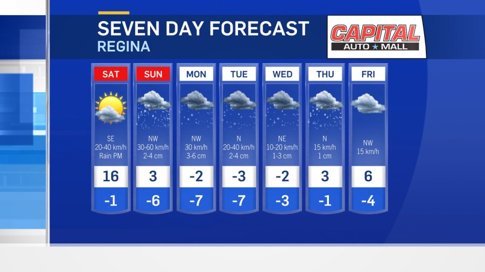
Before the storm makes its way into the province Saturday, temperatures will be above seasonal and fire danger will continue to be high. This, however, starts to change later in the day as a low-pressure system makes its way into the province from Alberta.
An Alberta clipper is the initiator of the change in conditions and will move in over Regina and Saskatoon in the late afternoon Saturday bringing rain with it.
Most communities in southern Saskatchewan will likely see rain on Saturday night before temperatures fall and the precipitation turns to snow through the day on Sunday. There is some risk of freezing rain overnight and into Sunday morning as well. Either way, it is going to be a bit of a wintry messy mixture until the chill settles in.
The clipper system moves into the U.S. on Sunday with a trough of low pressure remaining behind it that will turn into heavy snow as temperatures continue to cool. Our upper atmosphere pattern shows that a disturbance as well, helping to cool things down and keep conditions right for precipitation.
Then, we have to turn our attention to another geographic area for a moment. This is because another low-pressure system is moving up towards the Great Lakes through the U.S. and our clipper system looks to merge energy with this low. The entire system will then stall over Lake Superior.
That might seem far away, but it will keep a large swath of snow in place. This will keep the snow falling over both southern Manitoba and Saskatchewan. The heaviest accumulations in Regina look to be on Monday with three to six centimetres likely. However, over the 48 hour period between Sunday and Tuesday a total of 10 to 20 centimetres total will fall for most communities in these regions.
There is some question here because of the temperature profile and colder air. Rain could last longer on Sunday lessening the snowy impacts that day, but either way - expect a wet, snowy, wintry mess of a week.
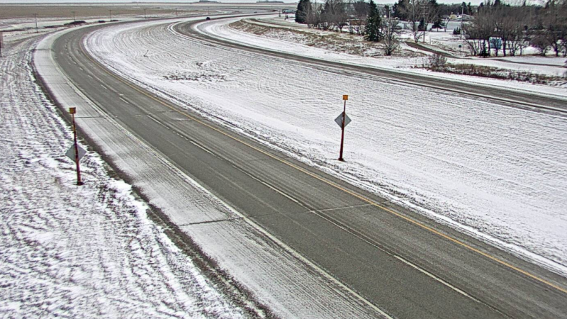
We are also going to see gusting winds with this system, particularly when the clipper moves through on Sunday with gusts to 60 km/h likely. This will lead to some blowing snow and decreased visibility. Travel looks to be tricky on Monday morning to start the week.
As this system finally starts moving and dissipating through mid-week, flurries continue into Wednesday and Thursday, with trace amounts likely on Thursday. After the remnants of this storm move out on Thursday, temperatures and conditions slowly head back to seasonal through next weekend with the sun finally coming back out.
But we really can’t complain too much since we need the precipitation to decrease fire danger in southern Saskatchewan and we’ve had almost two months of steady above seasonal temperatures.
