We exchange the stable hot conditions for more unstable and stormy weather today. A low that’s been building in central Alberta will track into Saskatchewan today, developing afternoon and evening thunderstorms.
Area: central and southern regions
Threats: hail, heavy downpours with 50-70 mm possible in some areas, wind gusts up to 110 km/h, development of funnel clouds and tornados

Ample pockets moisture levels will provide favourable dynamics for severe thunderstorms. The potential for funnel clouds will be most likely in southern areas of the province. Moisture is pooling along the cold front and trough of low pressure but with moisture being higher in some areas that others the storms will be very scattered throughout these areas. As this low track to the northeastern portion of Saskatchewan storms and showers will continue into the later evening hours.
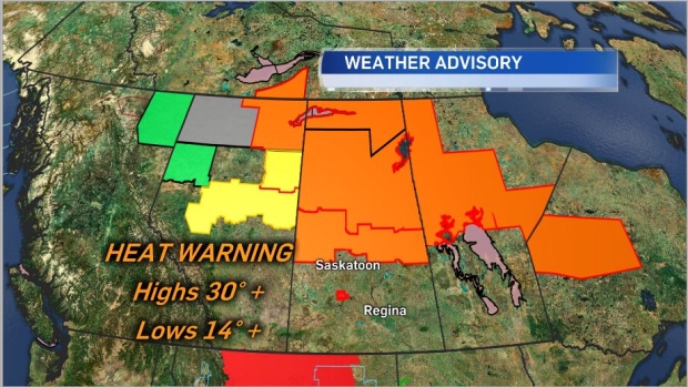
Even with this activity heat warning will continue for many areas of the province with a break coming Thursday and for the weekend. Air quality statements also remain in northern Saskatchewan due to forest fires.


