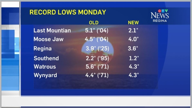
Monday was a chilly start for many in the province with several records lows set. A sweeping cold front brought the chill, and if you were camping somewhere you notice it when it passed through. Hot days have already arrived for the south western portion of Saskatchewan and will spread throughout on Wednesday. Expect highs in the 30s to roll right into the weekend.
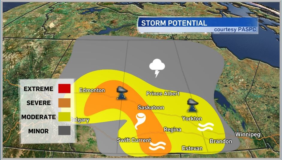
Before we get to the heat we’re still dealing with some instability in the province and that will create some more thunderstorm activity. As a low develops in southeastern Alberta the associated warm and cold fronts will produce severe thunderstorms. As per usual with any supercell storms the potential for funnel clouds and tornadoes is there. We’re looking at a couple of waves of storms this afternoon, the first is from the system moving from central Alberta to the northeast and firing up storms in the north-central regions of Saskatchewan. Next the warm front from that system will produce storms roughly from the North Battleford and Kindersley areas to Moose Jaw and Assiniboia, these are the storms we’re watching for severe activity with hail, strong winds, heavy downpours and possible funnel clouds.
Heading into the evening with the loss of daytime heating the warm front will weaken but storms are still expected in the Regina area. These storms will be less severe and they’re expected around 8 p.m., give or take an hour. The primary threat with these cells will be hail (pea to nickel sized) and downpours. Things will continue to calm and clear out into the overnight period.
Area: Southern/central
Timing: Afternoon/evening
Threats: 2-3 cm hail, 90-110 km/h wind gusts, heavy downpours, funnel clouds/tornadoes
For full local forecasts and weather warnings, download the CTV Regina Weather App.
